Jumat, 09 Maret 2012

Lombok Island paradise of the world

LOMBOK ISLAND BEAUTY WORLD LIKE PARADISE


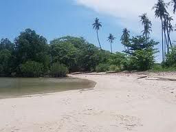
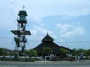
Lombok island has now become one of the tourist icons Indonesia, The beauty of the island is second to none in Indonesia, Agreeableness Sasak people, beauty of a very beautiful beaches, coral reefs and the wealth of incredible biological variety, splendor of Mount Rinjani and cultural uniqueness sasak many invites click fascinated the tourists at home and abroad who come to visit.


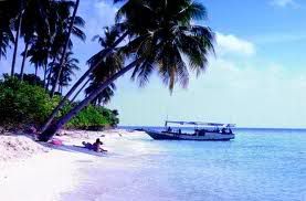
The beauty of the island of Lombok and eksotismenya will invite you and your partner to honeymoon here. Likewise with exotisme Gilis Island will also invite you to enjoy the beauty of the island.
This island is one of the two largest islands are owned by the Province of West Nusa Tenggara. the beauty of natural scenery, making the island of Lombok to be one honeymoon destination which is also in demand. If you already know where the feet should go, the beauty of Lombok can be explored on this trip. after you visit the island is my jamian you will feel at home here and are reluctant to return to your home.


Jumat, 06 Januari 2012

CURUG TUJUH BIDADARI

Seven Angels waterfall located in the Village Keseneng, Sumowono, Semarang regency.From Market Bandungan kept going in the direction Sumowono Market. Of this market, take the road towards Limbangan, Boja. After passing the Army barracks in Bantir, take the first fork to the left, and follow the signposts the way.


Seven Angels waterfall consists of several small waterfall, which formed three levels, with abowl-shaped pool at each level. Surrounding environment is still a lush mountains, and theexpanse of terracing rice fields are beautiful and green.


Development of the tourist area of ​​the Seven Angels waterfall was conductedindependently by Keseneng Village and surrounding communitiesWhen we visited there,being conducted with the street paving stones made ​​by the residentsBy utilizing river rockcarried around the waterfall.


BANDUNGAN SEMARANG


Bandungan mountain is a tourist attraction located in District BandunganSemarangregencyThese attractions can be reached by vehicle for 1 hour to the south of Semarang, or about 20 minutes from Ungaranor about 15 minutes from Ambarawa through mountain trailsBandungan has a cool and fresh air so that there are so many hotels and motelsAsthe famous tourism objects Gedongsongo TempleIn Bandungan there are manyinteresting attractions such as the area Sidomuktithere were a challenging arenaoutbound and beautiful sceneryResidential complex located in Hollywood there is also aspa area susan. The origins of the name Bandungan

Narrated from Couples K. Sanggem who obtained DI to look on the slopes of MountUngaran wellsie wells where the water flows like a river so that she can have children.After the well was found and he had many children, then he gets wangsit again to close the(stem) the well so as not to cause havoc to the village below itwith consequences in thevillage there will be no water springs and the well was finally closed with a gongThe village was finally in the know with Bandungan (dam). Kyai Sanggem tomb is behind theDistrict Office Bandungan.?
The most sought after tourist


Selasa, 27 Desember 2011

Mount Merapi

Mount Merapi


To name a mountain in West Sumatra with a similar name, see Mount Marapi.
Merapi

Altitude of 2968 m (9737 ft)
Thousand list, Volcano Type A
location
Location Klaten, Boyolali, Magelang (Central Java), Sleman (Yogyakarta)
Coordinates 7 ° 32'30 "latitude 110 ° 26'30" East
geology
Type stratovolcano
The last eruption 2010
Merapi (peak height of 2968 m above sea level, as of 2006) is a volcano in the central partof Java Island and is one of the most active volcanoes in Indonesia. Slopes of the south side are in administration Sleman, Yogyakarta Special Region, and the rest are in the region of Central Java Province, which is on the west side of Magelang regency, Boyolali District on the north and east, and Klaten on the southeastern side. Forest area around thepeak became Mount Merapi National Park area since 2004.
The mountain is very dangerous because, according to modern records have erupted(peak activity) every two to five years and is surrounded by very dense settlements. Since1548, this mountain has erupted 68 times as much. [Citation needed] The city of Magelang and the city of Yogyakarta is the nearest large city, is under 30 miles from its peak. On the slopes there is still a settlement to a height of 1700 m and is just fourkilometers from the summit. Because of this interest rate, Merapi became one of sixteenvolcanoes of the world are included in Decade Volcano projects (Decade Volcanoes).


2010 eruption of Mount Merapi


Mount Merapi erupted on Tuesday, the exact date is October 25, 2010 at 17:00 pm and the event is recorded eruption of Mount Merapi there are dozens of victims who have been berhil in evakusai to the hospital, and according to news Mbah Marijan died Merapi erupted in this event, the following seconds of entering the mountain in one of the most active volcanoes in the world is doing the activity vulkaniknya
After several days of volcanic activity of G. Merapi continues to increase in both number and energy signtfikan volcanic earthquakes, Tuesday (26/10) afternoon G. Merapi eruption phase. Here below chronological eruption G. Merapi, which occurred Tuesday afternoon until late night.
1. At 17:02 started happening awanpanas for 9 minutes2. At 17:18 there awanpanas for 4 minutes3. At 17:23 there awanpanas for 5 minutes4. Occurred awanpanas 17.30 for 2 minutes5. At 17:37 there awanpanas for 2 minutes6. At 17:42 there awanpanas great for 33 minutes7. At 18:00 until 18:45 there was a roar from Merapi Observation Post in Jrakah and Selo8. At 18:10, 18:15 o'clock, 18:25 o'clock the sound boom terdengan9. At 18:16 there awanpanas for 5 minutes10. At 18:21 there awanpanas great for 33 minutes11. From the observation post of Mount Merapi Selo visible flame along the column of smoke rose into the top at 1.5 km from the summit of Mount Merapi12. At 18:54 awanpanas activity began to subside13. Awanpanas glide leads kesektor Southwest and West-South-Southeast sector

Chronology of the eruption of Mount Merapi quoted Date October 26, 2010 issued by the Head of Geology, The Center for Volcanology and Geological Hazard Mitigation.
Mount Merapi volcano is a strato type, with an altitude of 2980 meters above sea level.Geographically located at position 7 ° 325 'south latitude and 110 ° 26.5' East longitude.administratively located in 4 regions ie Sleman district, Magelang regency, regency and district Boyalali Klaten. G. Status of activities Merapi increased from Normal became an Alert on September 20, 2010, increased to Standby on October 21, 2010 and became Beware, starting from October 25, 2010
Since the eruption of Mount Merapi are already dozens of people are confirmed dead and was taken to the nearest hospital,


condition after the eruption gunungmerapi


Mount Merapi Indonesia crying as if to say, that's news we often hear, Starting from flash floods in Wasior, the tsunami in the Mentawai and the eruption of Mount Merapi. But the sad news was also interspersed with Gaius news release from custody with a minimalist guise, which tarnished our law enforcement agencies.Earth is not static, but dynamic and constantly changing. Until now the change is still ongoing. As the continents move, an earthquake, volcano Merapi erupted, hurricanes, and irregularities occurred during the dry season and rainy season. The incident occurred outside the influence of human activities and humans are not able to prevent and block it.In predicting the location that will be affected by the disaster, you can use today's advanced technologies, namely through radar and optical satellite imagery. With the image data can be known condition before and after the eruption of Mount Merapi conditions, including changes in the crater.
For example, from satellite data are known before the eruption of Merapi crater 96 meters wide, whereas after the eruption changed significantly to 300 meters and a length of 1200 widened towards the west and south.
Energy eruption of Mount Merapi has not really stopped and is still happening tremors that punctuated the hot cloud, so the activity of Merapi is still happening. The growth of lava dome about 3.5 million cubic meters with an average growth of 28 cubic meters per second. Based on the calculation that 20 kilometers from the summit of Merapi is a scientific safe limits issued by the government.
Until now the condition of Mount Merapi is still in a state of "alert", which means it is a very dangerous condition. In this condition, the communities around Mount Merapi should be aware of activities that can only happen suddenly, like a cloud of hot and regurgitated material that is very dangerous. What to watch out for is a disaster can only come when people are being careless, so that current monitoring Mount Merapi should really be done carefully.
Since the eruption of Mount Merapi is vertically upwards, then it does not mean that the hot clouds glide direction will be in accordance with satellite imagery, but depending on the direction the wind is blowing. This is where the weakness of the satellite imagery.However, the image / photo can be used as scientific data. To determine the direction of clouds glide heat, cold or hot lava required intensive monitoring in the field.
Environmental damage by natural phenomena or due to natural events that occur in severe, thus affecting the environmental balance. Damage to the environment cause the man can not live in the neighborhood because of the danger and the proficiency level should be moved.
With the proliferation of environmental disasters, whether natural or man made, Indonesia should have a model in disaster management. This disaster management model should start from the growing awareness in the community will be a disaster that might occur such as floods, volcanic eruption, earthquake, landslide, tsunami and others. With the model of this disaster, we are expected to be better prepared to cope with disasters. Starting with early warning of disaster, the location of the refugee / gathering place, the number of medical personnel, the number of volunteers needed and the distribution of basic materials and logistics. So it is not too late yet, if the disaster occurs.
Eruption of Mount Merapi is destiny, the will of Allah, that no one could stop him.Environmental damage it causes to be evidence that humans are very dependent on the environment. Coincides with Eid al-Adha, may give the message that people must be "sacrificed" his life for the sake of environmental sustainability. And coincides with Memorial Day, there are still many people who called and care for each other, as volunteers, in helping to ease the burden on victims of Merapi, such as the promise of Allah "in difficulty there is relief".

 
Design by Free WordPress Themes | Bloggerized by Lasantha - Premium Blogger Themes | cna certification